

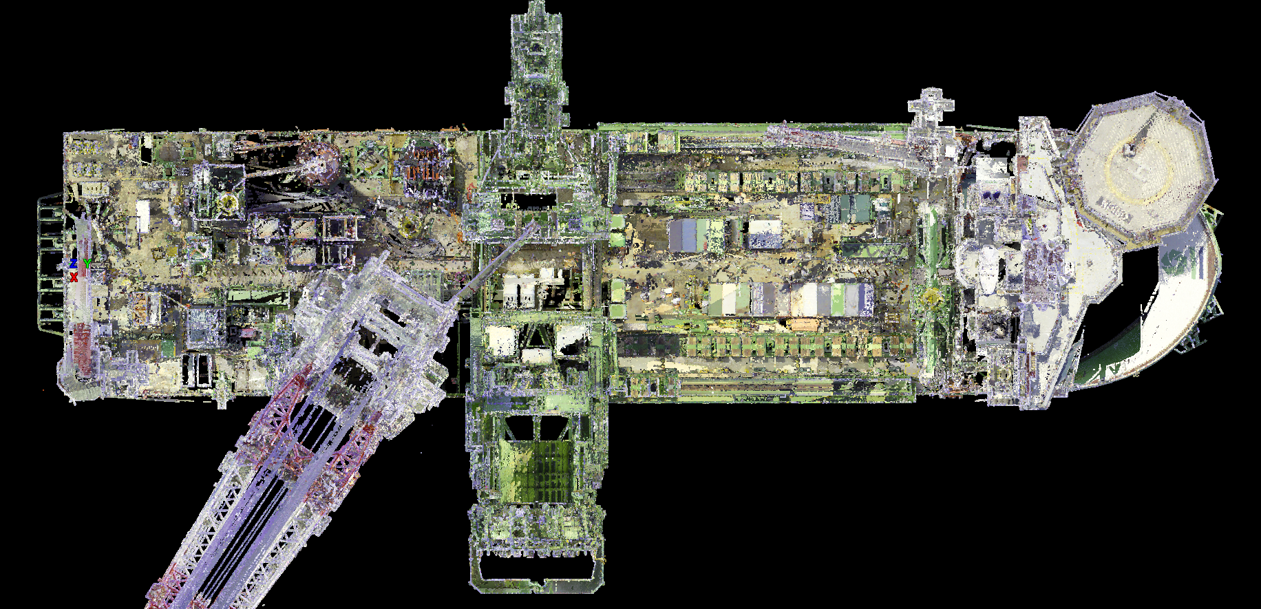
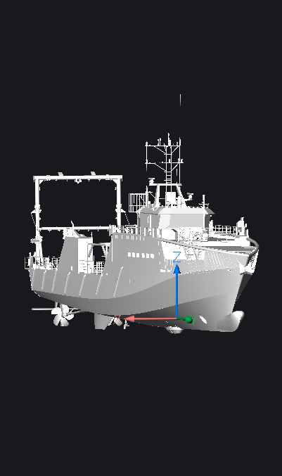
Laser Scanning and Vessel Information Modelling
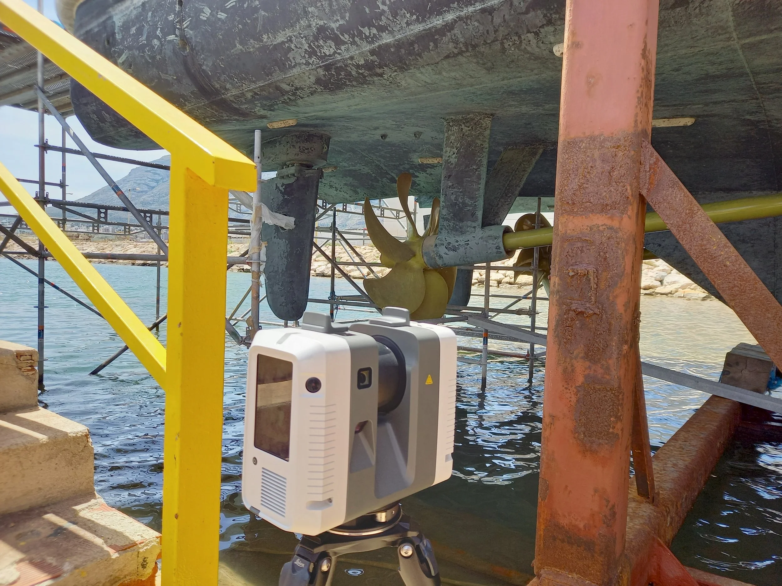
On site laser scanning using a variety of tools depending on your requirements.
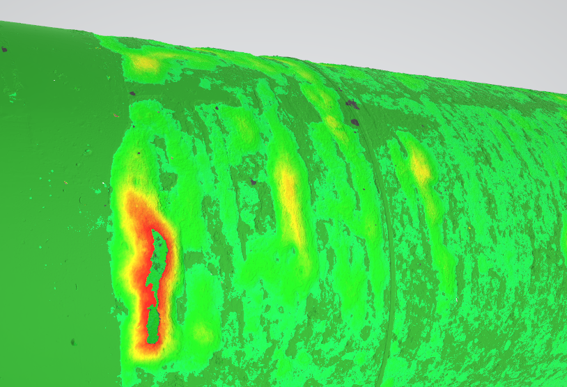
Measuring and monitoring of surface deformation and thickness.
Digitisation services.
GEOsolutions provide a range of services to digitise and document your engineering assets, on shore or at sea. Ranging from full vessel or structure scanning to sub millimetric measurements of components, capturing all levels of detail. These can be used for future project planning, regulatory compliance with design standards and analysis of construction tolerances.